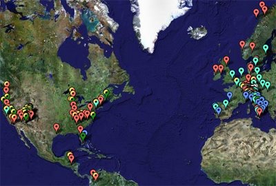
It's a satellite image of the Earth, where I superimposed markers that show (most of) the place that I have visited. When you click on a marker, a baloon pops up, with the description of the site and, in some cases, a small picture.
The map is a regular Google map, so you can navigate, zoom in and out, and explore.
At this time there are almost 200 markers, so it will take a few seconds to load (if you have high-speed internet - otherwise longer); please be patient. I will add more markers and pictures as I travel to new places.
If you want to make your own photo-travel-map, look at this tutorial.

No comments:
Post a Comment